Purpose
Students will learn about the management of a coastal fishery and the conservation career of fishery biologist, while using GIS (Geographic Information System) data to locate which watershed they live in and then determine which dams in their river’s watershed should have fish passage placed in them.
Duration
45 minutes to one hour
Materials
- One foot-long piece of string for each student group.
- Attachment 1 - Be a Fisheries Biologist for a Day: Watershed GIS Activity (1 per student)
- Attachment 2 - American Shad profile (1 per student)
- Attachment 3 -Profile of a Biologist (1 per student)
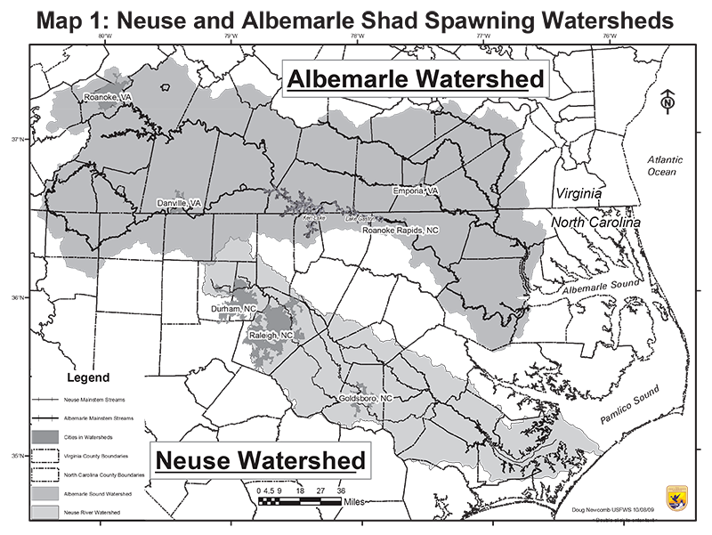
- Map 1 Neuse and Albemarle Shad Spawning Watersheds (1 per group)
- Map 2 Neuse Watershed with Dams in Study Watersheds (1 per group)
- Map 3a Walnut Creek Watershed above Lake Raleigh Dam (1 per group)
- Map 3b Crabtree Creek Watershed above Lassiter Mill Dam (1 per group)
- Map 3c Little River Watershed above Atkinson Mill Dam(1 per group)
- Map 3d Contentnea Creek Watershed above Wiggins Mill Dam (1 per group)
- Map 3e Neuse River Watershed above Milburnie Dam (1 per group)
Directions
- Give each student a copy Attachments 1, 2, 3
- Have each student read and the answer questions on Attachment 1.
- Break the students into small groups to do the Watershed GIS Activity.
- Hand out a set of watershed maps (Maps 1, 2, and 3a through 3e) and a piece of string to each group.
- Have students review the watershed maps in order, follow the Directions on how to work with their watershed maps and answer the questions on their student worksheets.
Extension Activities
Computer Activity: Have students go to the U.S. Geological Survey WaterWatch website. A map of the United States will appear with all of the river gauges in the U.S. that monitor river data. Students can click on North Carolina. They will be able to bring the cursor to each gauge and access the river conditions including flow in real time. They can then compare these current river flow rates to the flow rates that they calculated and answer the question:
- Q: Why are your numbers higher or lower now?
- A: Their numbers will be lower if there has been more rain in the watershed than the average rainfall and their numbers will be higher if there has been less rainfall than average.
Extra Readings on American Shad, Fish Passage Program
- Impacts of dam removals on migratory fishes in the Little River, North Carolina
- Response of American Shad and Striped Bass to Removal of Quaker Neck Dam(PDF, external link)
- Restoration Efforts Target American Shad in Roanoke River
- Restoring American Shad on the Roanoke River One Fish at a time
- Federal and State Fish Hatcheries Work to Restore Depleted Populations of American shad along the Atlantic Coast


